
Safety…There will be over 120 voluntary stewards and runners are asked to keep towards the left hand side of the road at all times even though there are full Road Closures, on the course unless otherwise instructed by a Marshall or Garda.
Start
The start location of the race is the same as 2012. With a larger number of participants it was thought safer and better overall for the race that the start continue to out on the road at the beginning of a long straight section of road.
The start is approximately 150 to 200m south of the entrance to St. Josephs. The first few hundred meters of the race is on a very straight and slightly downhill section of road which will result in a fast first mile for most runners.
Start Line Location

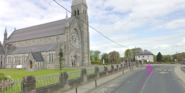
First Junction after 500m
After approx 500 metres, you come to the first junction and you keep on straight to the next T-junction where you’ll turn right and head east towards Kilmallock.
For safety reasons, you should stay on the left hand side of the road even though road closures are in place

Here you pass the cheese factories and pretty soon, you start to leave the town as you head towards Kilmallock. At this stage, there are some small undulations along the road but nothing very taxing or noticeable.

From here, there are a few minor bends in the road. Just after 2 miles, you come to the steepest hill along the course and strangely enough, it’s man-made. Up ahead is an old bridge under which ran the old direct railway line which went from Cork City to Limerick City…

As a hill, it’s pretty short and you have the benefit of a downhill on the other side. After this, the road begins to run parallel to the main Cork to Dublin railway line. Considering that these rail lines were laid for steam trains in the mid 19th century, the road here reflects this…..dead straight and very flat.
The first major junction is at approx 3.5 miles…..

Note that this is the start of the looped secion taking in the town of Kilmallock. Once the loop is completed, you will be retracing your steps back to Charleville and the finish line.
At approx 5.2 miles, the roads turns away from the railway line and heads towards the town of Kilmallock. This was one of the principal walled towns of the province of Munster in medieval times and almost seventy percent of walls are still standing today. There is plenty of evidence of this along the race course…

…….through the arch just after the 6 mile mark…….left at the next junction and through the town….


…..and then left at the main church in the town…
… and very soon, you are onto a very quiet country road…

There are a few bends but the road is mostly flat and straight. Near Mile 9…

…..and just before the 10 mile mark, you approach the end of the looped section……

You now run back towards Charleville and the finish line in St.Josephs.
Overall………A fast accurate Half-Marathon course which will suit anyone trying for a personal best time. With part of the entry fee going to St.Josephs Foundation and the long history of road races in this area, it deserves a good attendance.
